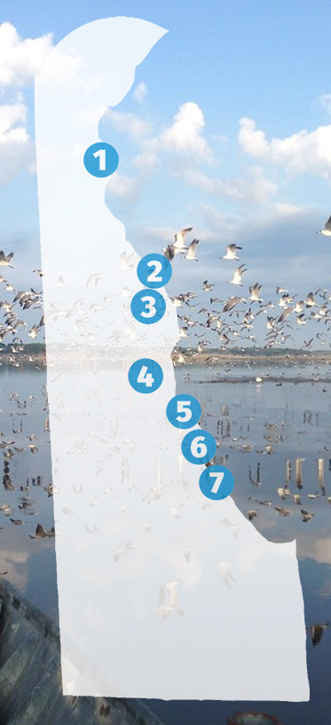
Many birds make their home along the Delaware Bayshore Byway and it provides amazing opportunities for birding and wildlife viewing throughout the year.
With so many sites, you may want to stay a night along the way and break this up into several days. Also, you can view the Delaware Birding Trail website for more information.
Birds & Wildlife
Wildlife Viewing
Walking Trails
Starting in Delaware City, Fort DuPont State Park and Fort Delaware provide unique opportunities to find beautiful birds.
The best birding is generally along the River View Trail. Scan the river from the overlook just beyond the parking lot. Yellow-crowned Night-Herons, scarce in Delaware, are commonly seen flying along the river banks. Follow the trail as it winds around and through a large grove of trees and past some old military bunkers. Be alert for songbirds in the thickets and fields, including warblers and sparrows.
Directions to the Fort Dupont River View Trail:
(39°34’23.60″N 75°34’50.56″W)
See on Google Maps
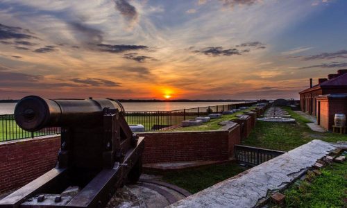
Fort Delaware is situated on Pea Patch Island, a 10-minute passenger ferry ride from Delaware City. Fort Delaware is a majestic Civil War-era masonry fort and the island’s undeveloped northern end boasts the largest mixed rookery of herons and egrets on the East Coast of the U.S. Prospective visitors should note that there is no public access to the immediate nesting area, but an observation platform approximately 300 yards from the south edge of the colony allows good views of the comings and goings of the adult birds. Once you have landed on the island, it is about 0.3 mile walk to the fort, and another 0.5 mile northwest from there to the observation point. A spotting scope is helpful, if you have one.
Directions to the Fort Delaware State Park ferry dock:
45 Clinton St, Delaware City, DE 19706
See on Google Maps

45 Clinton St.
Delaware City, DE 19706


Smyrna, DE 19977

Taylor’s Gut and nearby Florio Road, both part of Woodland Beach Wildlife Area, lie along Route 9, about 5 miles north of the entrance to Bombay Hook National Wildlife Refuge. From late October through mid-March, you may find the area teeming with Snow Geese and other waterfowl. Shorebirding is excellent when water levels are favorable.
Directions to Florio Road:
(39°19’31.41″N 75°30’25.04″W)
This road goes about 0.5 mile, and overlooks several ponds and fields. The road itself is unmarked, but there is a large sign reading, “Woodland Beach Wildlife Area.”
See on Google Maps
Directions to Taylor’s Gut:
(39°19’38.63″N 75°30’55.09″W)
A good spot from which to scan Taylor’s Gut is along the shoulder of Route 9 near a small culvert, 0.3 mile from the entrance to Florio Road.
See on Google Maps
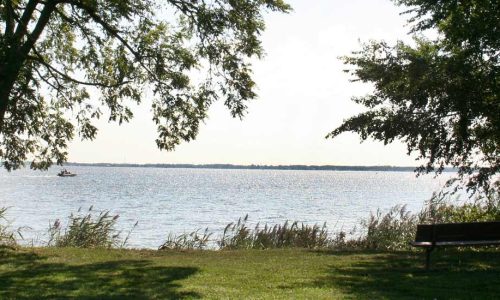
Unquestionably Delaware’s single best-known birding site, Bombay Hook National Wildlife Refuge justifies its fame with exceptional bird and wildlife viewing throughout the year. Centered around an Auto Tour loop road that traverses a cornucopia of habitats, including fresh and salt marshes, ponds, mudflats, woodlands, and fields. You should plan an absolute minimum of two hours for a visit here; four is much better, and you could easily make multiple trips over several days before really getting a feel for the varying diurnal and tidal rhythms.
Open fields and plantings attractive to native wildlife surround the Visitor Center. Pick up a copy of the Auto Tour pamphlet, which includes a detailed map, and much useful information. The numbers in the following paragraphs refer to the tour stops in the brochure.
The best birding at Raymond Pool is usually to be found along the long, straight stretch of dike road (Tour Stop #3) that borders the northeast edge of the pool, beginning about 1 mile from the visitor center. Note that along Raymond Pool, as in most of the refuge, the dike road divides the freshwater impoundment from tidal saltmarsh.
Other noteworthy areas around Raymond Pool include the observation tower, a short walk from the first parking area on the left (N) side of the road, and the boardwalk trail, which enters the woods on the right (S) side of the road, just a few hundred yards beyond the tower parking lot. The woods at the beginning of the boardwalk trail can be particularly good for migrant songbirds. The boardwalk trail itself is a great place to see breeding Marsh Wrens and Seaside Sparrows and to listen for rails. Both of these spots are reached on the one-way portion of the Auto Tour before Tour Stop #3.
Directions to Bombay Hook National Wildlife Refuge
2501-2599 Refuge Entrance Rd, Smyrna, DE 19977
See on Google Maps
2501-2599 Refuge Entrance Rd.
Smyrna, DE 19977
Leipsic, DE 19901
The Ted Harvey Conservation Area near St. Jones Neck consists of four different tracts. The Logan Lane tract is dependably productive for a fine variety of marsh and bayside birds and may produce less common species like American Avocet, Black Skimmer and Gull-billed Tern. North America’s first Whiskered Tern spent several weeks here in 1993.
There are three principal areas birders cover at the Logan Lane Tract: the north impoundment and the bayshore, both reached by the northern access road, and the south impoundment. Note that birding access to this area may at times be restricted during hunting seasons.
Directions to the Logan Lane Tract:
From the intersection of Route 9 & US 113, just south of Dover, take Road 68 (Kitts Hummock Road) to the east. Turn right (S) at the brown sign reading, “Ted Harvey Conservation Area – Logan Lane Tract” on the right (S) side of the road, just under 2 miles from Routes 9 & 113.
See on Google Maps
Directions For the North Impoundment:
(39° 5’29.59″N 75°24’26.61″W)
Take the first left (E), 0.4 mile after leaving Road 68, just before the house on the right. Continue 0.6 mile farther, then turn left (NE), arriving at the impoundment shore in 0.4 mile.
For the Bayshore, (39° 5’7.37″N 75°24’18.49″W), instead of turning left for the north impoundment, continue about 0.5 mile to the small parking area.
From there, walk the quarter mile east towards the bay, birding the marsh and mudflats along the way. At the bay, you may also wish to turn right (S) and walk down the beach, scanning the bay, the shoreline, and the eastern edge of the south impoundment, visible across the dunes to the west.
See on Google Maps
Directions For the South Impoundment:
(39° 4’34.21″N 75°25’1.72″W)
To reach the road access point for the south impoundment, return to the main entrance road, turn left (S) and go past the house, then make a left (E), 0.5 mile past the house. Another 1.0 mile brings you to the impoundment.
See on Google Maps
Start exploring at Big Stone Beach and Milford Neck – arguably Delaware’s least-known great birding area. Big Stone Beach Road, specifically the two and a half mile stretch from Scott’s Corners to Big Stone Beach, which winds past beautiful coastal forests, freshwater marshes, and out to the Delaware Bay.
The marshlands anywhere east of Scott’s Corners are excellent for rails including Virginia and Sora, possibly even Black, though seeing any of them is tough. Access is limited to the public roadways; please do not attempt to enter the marsh.
Both Chuck-will’s-widows and Whip-poor-wills are numerous and vocal in the woodlands during spring and summer. Check the pines for the last half mile or so before the beach-they are often attractive to migrants.
The bayshore itself can be productive for ducks, gulls, and shorebirds.
Directions to Big Stone Beach:
220 S Big Stone Beach Rd, Milford, DE 19963
See on Google Maps
354 State Rd 15
Milford, DE 19963
Slaughter Beach is typically the best place in Delaware to see Red Knots gorging on horseshoe crab eggs in spring, but that is only the tip of the iceberg. The DuPont Nature Center allows visitors to access a wealth of information about the horseshoe crab/shorebird phenomenon and observe it, simultaneously. As such, it is an ideal starting point for any visitor wanting to experience Delaware Bay’s premier wildlife spectacle. Though the peak of shorebirds and horseshoe crabs is brief, the nature center and the area around it are worth a visit all year round.
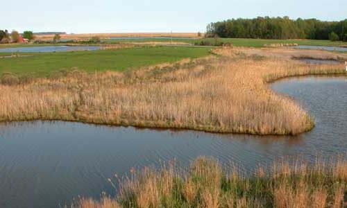
The gravel bars and shell reefs at the mouth of the Mispillion River are good places to find gulls, terns and American Oystercatchers. The marsh along Lighthouse Road, is thick with Clapper Rails and Seaside Sparrows, and may have Short-eared Owls in winter. Both Nelson’s and Saltmarsh sharp-tailed sparrows are found here in season.
Be sure and check out the Marvel Salt Marsh Preserve just south of the DuPont Nature Center. This marsh ecosystem has a recently added wooden boardwalk allowing access for all to the heart of the marsh itself. In summer, the sounds of Marsh Wrens, Seaside Sparrows, and Clapper Rails fill the air. Great Egrets, Northern Harriers, and Osprey search for prey. The constructed nest platform gives opportunities to view an active Osprey nest.
The bayshore itself can be accessed from a number of points in the town of Slaughter Beach, with those on the north end of town (nearer the nature center) often being the most productive for shorebirds and least populated by beachcombers, bathers, and other non-birding visitors. Please take care to not disturb shorebird feeding activity, and be careful to avoid trespassing.
Directions to DuPont Nature Center:
2992 Lighthouse Rd, Milford, DE 19963
See on Google Maps
Directions to the Marvel Salt Marsh Preserve
Bay Av., Milford, DE
See on Google Maps
Prime Hook National Wildlife Refuge easily ranks among the mid-Atlantic region’s very finest birding spots, though it has never achieved quite the renown of its sister refuge, Bombay Hook, mostly because of Prime Hook’s somewhat more confusing geographic layout. Though it takes a little while to orient oneself to the several access points, it’s more than worth the effort.
Broadkill Beach Road slices across the southern portion of the refuge, and allows access to the Headquarters Area, with its expanding network of foot trails, and the very productive Broadkill Impoundment. Farther north, sections of Prime Hook Beach Road and Fowler Beach Road traverse diverse wetland habitats and also offer fantastic birding. It is easy to spend anywhere from a few hours to several days exploring Prime Hook.
Directions to the Headquarters Area:
11978 Turkle Pond Rd, Milton, DE 19968
See on Google Maps
Directions for the Broadkill Impoundment
38°49’15.55″N 75°13’7.79″W
Return to Broadkill Beach Road, turn left (E), and go 2.2 miles. The impoundment is on the right (SE) after the large bend in the road.
See on Google Maps
Directions to Prime Hook Beach Road:
38°51’17.48″N 75°16’1.83″W, and east for 1.3 miles
Turn right (NE) on Prime Hook Road, then go 0.9 mile before bearing right at the fork to stay on Prime Hook Road. The prime birding area begins about 2.4 miles past that fork and runs another 1.3 miles east to the bay.
See on Google Maps
Directions to Fowler Beach Road:
38°52’49.51″N 75°16’13.68″W Go right (E) on Fowler Beach Road about 2 miles to a marsh and wetlands area just short of the bayshore. There is a viewing platform on the north side of the road near the bay, a good place from which to scan both the marsh and the shoreline.
See on Google Maps
11978 Turkle Pond Rd
Milton, DE 19968
Get discounted experiences and special offers for shopping, dining, attractions, and leisure along the byway.
Delaware Greenways extends its thanks to the Delaware Department of Transportation, Delaware Department of Natural Resources and Environmental Control and Delaware Tourism Office for their generous support in the development of the Delaware Bayshore Byway website.
Lorem ipsum dolor sit amet, consectetur adipiscing elit. Ut elit tellus, luctus nec ullamcorper mattis, pulvinar dapibus leo.
Lorem ipsum dolor sit amet, consectetur adipiscing elit. Ut elit tellus, luctus nec ullamcorper mattis, pulvinar dapibus leo.
Lorem ipsum dolor sit amet, consectetur adipiscing elit. Ut elit tellus, luctus nec ullamcorper mattis, pulvinar dapibus leo.